Google Backs FireSat: A Game-Changer in Global Wildfire Detection
Wildfires are becoming more frequent and devastating, fueled by climate change and dry conditions. These disasters destroy millions of acres, displace communities, and cost billions in damages each year. Early detection is the key to minimizing wildfire destruction, but traditional satellite imaging can take hours to detect and relay fire alerts.
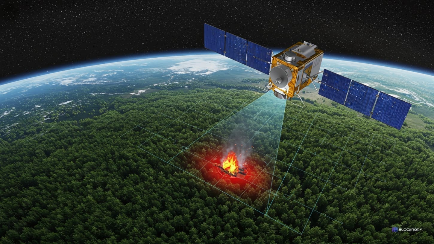
Now, a Google-backed satellite network called FireSat, developed in collaboration with Muon Space, is set to revolutionize wildfire detection. With AI-powered real-time monitoring from space, FireSat aims to track and alert emergency responders faster than ever before.
The First FireSat Satellite is Live
The first satellite in the FireSat constellation has made contact with Earth, marking a significant milestone in the project’s mission to revolutionize wildfire detection. This satellite is the first of more than 50 planned for deployment, creating a first-of-its-kind AI-powered network dedicated to tracking and detecting wildfires from space.
With this constellation, FireSat will update high-resolution thermal imagery every 20 minutes, giving firefighters and disaster response teams real-time data to act quickly and effectively.
How FireSat Works

FireSat operates through a combination of AI, advanced imaging, and real-time data analysis, making it a game-changer in wildfire detection:
- AI-Powered Rapid Detection: FireSat compares live images with historical satellite data to identify anomalies that indicate fire activity.
- Real-Time Updates: The system refreshes global wildfire data every 20 minutes, providing near-instant situational awareness.
- Contextual Analysis: FireSat doesn’t just detect heat signatures; it considers nearby infrastructure, local weather, and vegetation conditions to determine fire risks more accurately.
- Immediate Alerts: FireSat’s AI-driven processing reduces detection times to minutes instead of hours, allowing faster emergency responses.
Why FireSat is a Game-Changer
Current satellite wildfire detection relies on orbital paths, meaning a fire can burn for hours before it’s spotted. FireSat’s constellation will cover the entire planet with high-frequency updates, meaning fires can be detected almost as soon as they ignite.
Analyzing images against previous data is a crucial advantage, as it ensures that false alarms are minimized while legitimate fire threats are flagged immediately.
Google’s Role in FireSat
Google has been working on wildfire tracking technology for years, integrating AI-powered Wildfire Alerts into Google Search and Maps. With FireSat, the company is scaling up its efforts by contributing expertise in AI, cloud computing, and geospatial analysis to improve global wildfire response.
By efficiently processing vast amounts of thermal imaging data, Google’s AI helps FireSat deliver highly accurate, real-time wildfire alerts to firefighters, governments, and disaster relief teams worldwide.
A New Era in Wildfire Prevention
FireSat is more than just a technological breakthrough; it’s a vital tool in protecting forests, communities, and wildlife. FireSat could significantly reduce wildfire damage and response times by providing fast, high-resolution, AI-driven insights.
As climate change continues to increase the frequency of extreme wildfire seasons, FireSat represents a new frontier in disaster prevention technology. It offers a future where wildfires can be stopped before they become unstoppable.
With Google and Muon Space leading this mission, FireSat is set to redefine wildfire detection, proving that AI and space technology can work together to safeguard our planet.